– by Ernest Joseph
When I woke up on August 18, 2013 in the village of Llanberis, Wales; and look up to see if I can see the top of Snowdon Mountain, I was happy to see the summit clearly! Although months between June – August are the best tie of the year to visit Eyri National Park (Snowdonia), the summit can still be under cloud on seemingly clear day at sea level.
The name ‘Snowdon’ means ‘Snow Hill’ and snow can often be seen covering parts of the mountain. Whilst the Welsh name ‘Yr Wyddfa’ translates to ‘Burial Place’, which may refer to the fact that Snowdon is said to be the mythical resting place of Rhitta Gawr – the giant killed by King Arthur.
Snowdon is the highest mountain in Wales and England at 1085 meters (3560 feet) and the highest point in the British Isles outside Scotland. I was a frequent visitor to this region of Wales from 2010 to 2016. My work at Siemens brought me to Llanberis frequently.
During this period, my sight was always on climbing to the summit of this mountain. Finally on August 18, 2013, I had my best chance to climb.
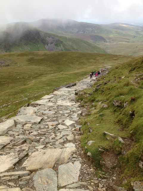
There are six different paths that lead to the summit of Snowdon. I decided to take the Llanberis Path. The Llanberis Path is the longest and most gradual path to the summit and offers fantastic views of the surrounding area. It follows close to the line of the railway, and being the easiest ascent, it is the route used by the annual Snowdon Race. But don’t let the “easiest ascent” fool you. The Snowdonia National Park Authority classifies Llanberis Path as a hard and strenuous route.
The section of the Llanberis Path above Clogwyn station has long been called the “Killer Convex”; in icy conditions, this convex slope can send unwary walkers over the cliffs of Clogwyn Du’r Arddu. Four people died there in February 2009.
The starting point of the path is Snowdon Mountain Railway Station. The distance to the summit and back is 9 miles. Total ascent is 975 meters (3,200 ft.), and the grade is 14.1%
While I was never able to coordinate my trip during middle of July when the famous Snowdon race takes place, I was determined to run and not walk the entire distance.
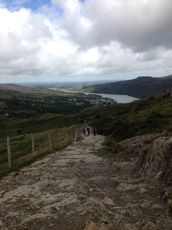
The start is a gentle rise up a country road, following the snaking road; leading to the proper trail. The gentle incline along the mountainside continues for a good few miles. This allowed me to enjoy and take in the jaw-dropping panoramas of the Welsh valley. This gentle ascent continues past the Half-way House to mark the halfway point of the ascent.
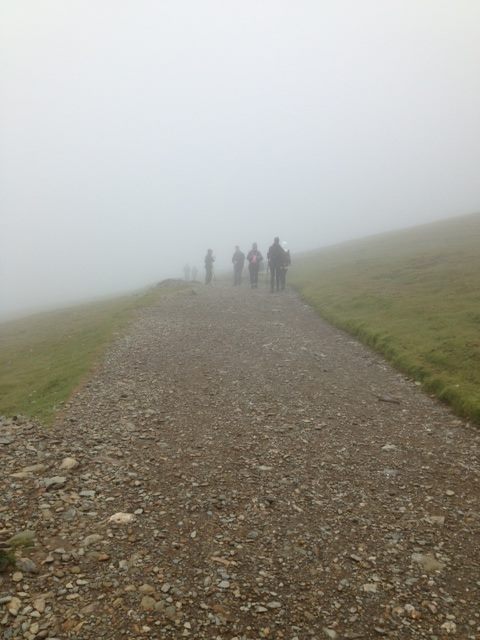
The terrain changes as soon as you reach the final quarter of the peak where I was faced with a sudden sharp rise at Allt Moses.
While this climb is relatively brief, it’s still very steep and is guaranteed to get those legs burning! The gradient does begin with some stone steps, but for the rest of this segment I was plodding along the eroded and gravelly path. Had to be cautious here as the rocks were quite loose.
The incline briefly relents at Clogwyn Station, where I was treated to a short flat segment under the railway bridge. I continued the climb and made sure that I don’t stray close to the edge since the drop gets incredibly steep. This is best known as the Killer Convex; a notoriously dangerous segment in winter. On a clear day with good visibility however, I did not have any trouble navigating the wide path safely.
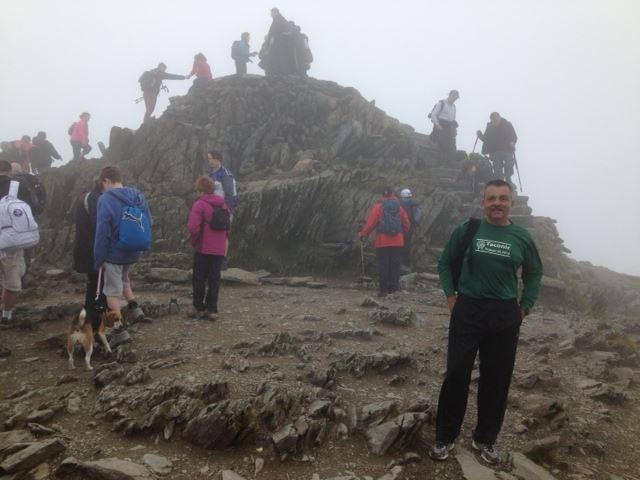
With the summit in sight, I completed the last leg of the climb where the Llanberis Path joins with the Snowdon Ranger, PYG and Miner’s Track.
Once I reached the peak, I took time to recoup and take in the glorious vistas before heading back down the way I came.